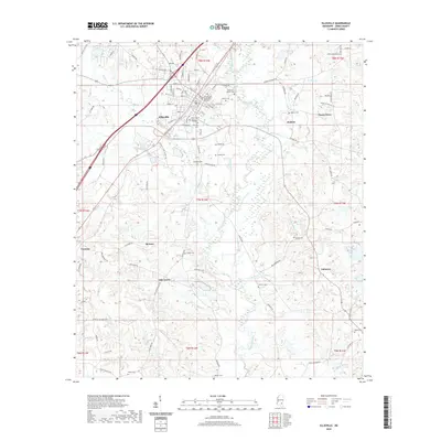
2020 Map of Ellisville
USGS Topo · Published 2020About this map
Ellisville serves as a significant hub in Jones County, centered around the Jones County Courthouse and the sprawling campus of Jones County Junior College. The landscape is defined by the winding course of Tallahala Creek and its many tributaries, including Rocky Cr and Johnson Creek, which cut through the undulating terrain. A dense network of local roads like Buffalo Hill Rd and Tuckers Crossing Rd connects smaller communities such as Pecan Grove, Tawanta, and Oak Grove. For genealogists, the map is a vital resource, identifying numerous family-named burial sites including Bynum Cem, Anderson-Minter Cem, and Walters Cem. The distribution of these cemeteries and small settlements reflects a settlement pattern rooted in the various branches and creeks, such as Woodards Mill Cr and Gator Br, that historically shaped the region's movement and development.
Find a feature on this map
91 named features on this map. Tap any name to fly to it.
Don’t see what you’re looking for? This feature index may not catch every label — zoom into the map to look around manually.
Map Details
Editions of this 2020 Ellisville Map
This is the sole edition of this map. No revisions or reprints were ever made.
Other maps of this area

1953 · Hattiesburg
USGS Topo · 1:250,000

1958 · Hattiesburg
USGS Topo · 1:250,000

1963 · Barrontown
USGS Topo · 1:24,000

1964 · Laurel East
USGS Topo · 1:24,000

1964 · Laurel West
USGS Topo · 1:24,000

1964 · Ovett
USGS Topo · 1:24,000

1964 · Ellisville
USGS Topo · 1:24,000

1964 · Lanham
USGS Topo · 1:24,000

1965 · Hebron
USGS Topo · 1:24,000

1965 · Eastabuchie
USGS Topo · 1:24,000