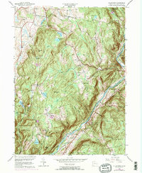
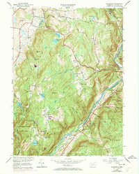
1956 Map of Ellsworth
USGS Topo · Published 1971About this map
Sharon Mountain and the high ridges of Litchfield County dominate this 1956 landscape, showing the rural character of northwestern Connecticut during the mid-20th century. The Housatonic River carves a deep valley along the eastern edge of the map, followed closely by the tracks of the Penn Central railroad. This river corridor serves as the primary artery for transportation, contrasting with the winding mountain roads like Guinea Road and Herrick Road that connect scattered hamlets.
Find a feature on this map
56 named features on this map. Tap any name to fly to it.
Don’t see what you’re looking for? This feature index may not catch every label — zoom into the map to look around manually.
Map Details
Editions of this 1956 Ellsworth Map
5 editions found
Other maps of this area

1892 · Cornwall
USGS Topo · 1:62,500

1892 · New Milford
USGS Topo · 1:62,500

1893 · New Milford
USGS Topo · 1:62,500

1893 · Cornwall
USGS Topo · 1:62,500

1893 · Clove
USGS Topo · 1:62,500

1894 · Clove
USGS Topo · 1:62,500

1898 · Clove
USGS Topo · 1:62,500

1899 · Millbrook
USGS Topo · 1:62,500

1901 · Clove
USGS Topo · 1:62,500

1902 · Millbrook
USGS Topo · 1:62,500