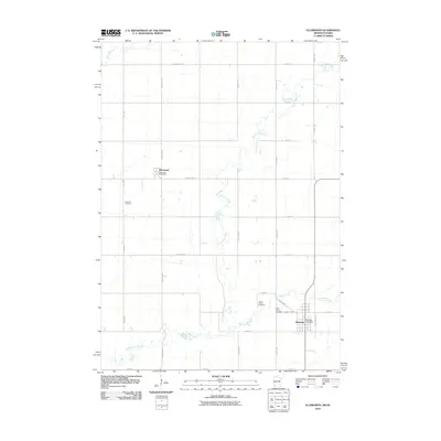
2010 Map of Ellsworth
USGS Topo · Published 2010About this map
Ellsworth anchors this southwestern Minnesota survey, situated along the Iowa border within a landscape defined by organized section lines and prairie waterways. The map illustrates a settled agricultural region where the Ellsworth Post Office and local landmarks like Saint Mary's Cemetery serve the community. To the north, the small settlement of Kanaranzi sits along County Hwy-15, featuring its own Kanaranzi Post Office. The topography is shaped by the winding paths of Kanaranzi Creek and its tributaries, Norwegian Creek and Elk Creek, which break the geometric grid of roads like Birkett Ave and Abbott Ave. Genealogists will find several burial grounds documented, including Ashwood Cemetery and Grand Prairie Cemetery, providing important markers for local family histories in Nobles County.
Find a feature on this map
31 named features on this map. Tap any name to fly to it.
Don’t see what you’re looking for? This feature index may not catch every label — zoom into the map to look around manually.
Map Details
Editions of this 2010 Ellsworth Map
This is the sole edition of this map. No revisions or reprints were ever made.
Other maps of this area

1954 · Fairmont
USGS Topo · 1:250,000

1955 · Sioux Falls
USGS Topo · 1:250,000

1958 · Sioux Falls
USGS Topo · 1:250,000

1958 · Fairmont
USGS Topo · 1:250,000

1967 · Magnolia
USGS Topo · 1:24,000

1967 · Adrian SW
USGS Topo · 1:24,000

1967 · Adrian
USGS Topo · 1:24,000

1967 · Ellsworth
USGS Topo · 1:24,000

1967 · Ash Creek
USGS Topo · 1:24,000
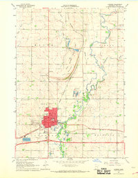
1967 · Luverne
USGS Topo · 1:24,000