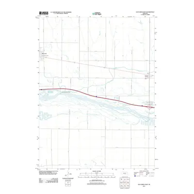
2011 Map of Elm Creek East
USGS Topo · Published 2011About this map
The Platte River corridor dominates this central Nebraska landscape, showing the complex braided hydrology of the North Channel Platte River and South Channel Platte River. The settlement of Elm Creek serves as a primary hub in the northwest, supported by the Elm Creek Post Office, while the village of Odessa anchors the eastern edge of the survey. The engineered water system is a defining feature of the region, notably the Kearney Canal which originates at the Kearney Diversion Dam and traverses the valley floor.
Find a feature on this map
42 named features on this map. Tap any name to fly to it.
Don’t see what you’re looking for? This feature index may not catch every label — zoom into the map to look around manually.
Map Details
Editions of this 2011 Elm Creek East Map
This is the sole edition of this map. No revisions or reprints were ever made.
Other maps of this area

1894 · Kearney
USGS Topo · 1:62,500

1896 · Kearney
USGS Topo · 1:125,000

1955 · Grand Island
USGS Topo · 1:250,000

1957 · Grand Island
USGS Topo · 1:250,000

1958 · Grand Island
USGS Topo · 1:250,000

1961 · Elm Creek West
USGS Topo · 1:24,000

1961 · Amherst
USGS Topo · 1:24,000

1961 · Miller SW
USGS Topo · 1:24,000

1962 · Riverdale
USGS Topo · 1:24,000

1962 · Elm Creek East
USGS Topo · 1:24,000