
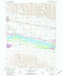
1962 Map of Elm Creek East
USGS Topo · Published 1964About this map
The braided waters of the Platte River dominate this Central Nebraska landscape, dividing into the North Channel and South Channel around Long Island. Significant infrastructure of the early 1960s is evident, notably the section of Interstate 80 marked as Under Construction, paralleling the historic route of the Union Pacific railroad and the Kearney Canal. The village of Elm Creek and the settlement of Odessa serve as focal points for the agricultural region, supported by a network of water features including Turkey Creek, Buffalo Creek, and the evocative Whisky Slough. Local industry is represented by several Gravel Pits along the riverbanks, while a small Landing Field and a river Gaging Station indicate the area's role in local transportation and water management during this era of mid-century development.
Find a feature on this map
25 named features on this map. Tap any name to fly to it.
Don’t see what you’re looking for? This feature index may not catch every label — zoom into the map to look around manually.
Map Details
Editions of this 1962 Elm Creek East Map
2 editions found
Other maps of this area

1894 · Kearney
USGS Topo · 1:62,500

1896 · Kearney
USGS Topo · 1:125,000

1955 · Grand Island
USGS Topo · 1:250,000

1957 · Grand Island
USGS Topo · 1:250,000

1958 · Grand Island
USGS Topo · 1:250,000

1961 · Elm Creek West
USGS Topo · 1:24,000

1961 · Amherst
USGS Topo · 1:24,000

1961 · Miller SW
USGS Topo · 1:24,000

1962 · Riverdale
USGS Topo · 1:24,000
1962 · Alfalfa Center
USGS Topo · 1:24,000