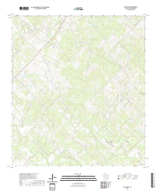
2022 Map of Elm Creek
USGS Topo · Published 2022About this map
The Rossler Ranch Airport serves as a lone modern landmark in this expansive reach of South Texas ranch land. This portion of Live Oak County is defined by an intricate drainage system, where Elm Creek and Ramirena Creek navigate a landscape marked by numerous water collection points. These features, often named for local wildlife or ranching needs, include Javelina Tank, Agarita Tank, and Alamo Tank.
Find a feature on this map
24 named features on this map. Tap any name to fly to it.
Don’t see what you’re looking for? This feature index may not catch every label — zoom into the map to look around manually.
Map Details
Editions of this 2022 Elm Creek Map
This is the sole edition of this map. No revisions or reprints were ever made.
Other maps of this area

1920 · Mikeska
USGS Topo · 1:125,000

1925 · Oakville No. 4
USGS Topo · 1:48,000

1927 · Oakville
USGS Topo · 1:62,500

1929 · Simmons
USGS Topo · 1:62,500

1953 · Crystal City
USGS Topo · 1:250,000

1955 · Crystal City
USGS Topo · 1:250,000

1961 · Crystal City
USGS Topo · 1:250,000
1963 · Anna Rose
USGS Topo · 1:24,000
1963 · Crater Ridge
USGS Topo · 1:24,000
1963 · Elm Creek
USGS Topo · 1:24,000