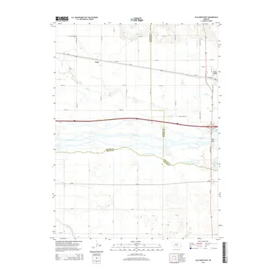
2014 Map of Elm Creek West
USGS Topo · Published 2014About this map
The Platte River valley dominates this portion of Nebraska, where a complex network of waterways and irrigation infrastructure supports the agricultural landscape. The main stem of the river and the S Channel Platte River create a braided hydrologic pattern, anchored by the Platte River Bridge on the eastern edge. Settlement is concentrated around Elm Creek, while the smaller locality of Trued sits further west along the established transportation corridor of Us-30. The presence of the Dawson-County Canal and the Phelps County Canal in the north and south illustrates the vital role of water management in this prairie region. These artificial waterways run parallel to natural drainage like Elm Cr and Turkey Cr, defining the rural grid. Major transit routes, including Interstate 80, slice through the center of the quadrangle, bridging the gap between historical river crossings and modern highway infrastructure.
Find a feature on this map
32 named features on this map. Tap any name to fly to it.
Don’t see what you’re looking for? This feature index may not catch every label — zoom into the map to look around manually.
Map Details
Editions of this 2014 Elm Creek West Map
This is the sole edition of this map. No revisions or reprints were ever made.
Other maps of this area

1896 · Lexington
USGS Topo · 1:125,000

1896 · Kearney
USGS Topo · 1:125,000

1899 · Lexington
USGS Topo · 1:125,000

1955 · Grand Island
USGS Topo · 1:250,000

1957 · Grand Island
USGS Topo · 1:250,000

1958 · Grand Island
USGS Topo · 1:250,000

1961 · Elm Creek West
USGS Topo · 1:24,000

1961 · Amherst
USGS Topo · 1:24,000

1961 · Miller SW
USGS Topo · 1:24,000

1962 · Elm Creek East
USGS Topo · 1:24,000