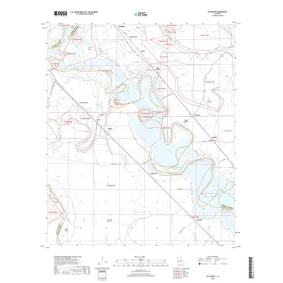
2018 Map of Elm Grove
USGS Topo · Published 2018About this map
The Red River meanders through the heart of this Caddo and Bossier Parish landscape, creating a complex network of oxbows and secondary waterways like Old River Lake and Half Moon Lake. Small settlements such as Elm Grove and Caspiana anchor the riverfront, while the Caspiana Levee Rd follows the winding banks of the main channel. The terrain is defined by low-lying basins and bayous, including the Cannisnia Lake Basin and Negro Bayou, which reveal the area's history as a flood-prone alluvial plain.
Find a feature on this map
59 named features on this map. Tap any name to fly to it.
Don’t see what you’re looking for? This feature index may not catch every label — zoom into the map to look around manually.
Map Details
Editions of this 2018 Elm Grove Map
This is the sole edition of this map. No revisions or reprints were ever made.
Other maps of this area

1938 · Arnsberg
USGS Topo · 1:31,680

1941 · East Point
USGS Topo · 1:31,680

1941 · Forbing
USGS Topo · 1:31,680

1941 · Bossier Point
USGS Topo · 1:31,680

1945 · Mansfield
USGS Topo · 1:62,500

1947 · Ringgold
USGS Topo · 1:62,500

1947 · Mansfield
USGS Topo · 1:62,500

1948 · Coushatta
USGS Topo · 1:62,500

1948 · Caspiana
USGS Topo · 1:62,500

1955 · Shreveport
USGS Topo · 1:250,000