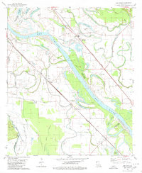
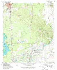
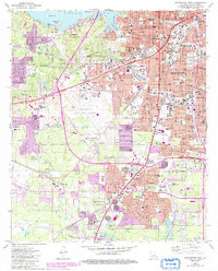
1980 Map of Elm Grove
USGS Topo · Published 1980This historical map portrays the area of Elm Grove in 1980, primarily covering Caddo Parish as well as portions of Bossier Parish and De Soto Parish. Featuring a scale of 1:24000, this map provides a highly detailed snapshot of the terrain, roads, buildings, counties, and historical landmarks in the Elm Grove region at the time. Published in 1980, it is one of 2 known editions of this map due to revisions or reprints.
Find a feature on this map
54 named features on this map. Tap any name to fly to it.
Don’t see what you’re looking for? This feature index may not catch every label — zoom into the map to look around manually.
Map Details
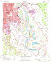
Editions of this 1980 Elm Grove Map
2 editions found
Historical Maps of Morameal Through Time
23 maps found

1932 Hosston NW
Caddo Parish, LA

1932 Hosston SE
Caddo Parish, LA

1932 Hosston SW
Caddo Parish, LA

1932 Shreveport NE
Caddo Parish, LA

1932 Shreveport SE
Caddo Parish, LA

1941 Forbing
Caddo Parish, LA

1955 North Shreveport
Caddo Parish, LA

1955 Shreveport East
Caddo Parish, LA

1955 Shreveport West
Caddo Parish, LA
1959 Shreveport East
Caddo Parish, LA
1959 Shreveport West
Caddo Parish, LA
1960 North Highlands
Caddo Parish, LA

1971 Vivian North
Caddo Parish, LA
1971 Vivian South
Caddo Parish, LA

1975 North Highlands
Caddo Parish, LA

1975 Shreveport East
Caddo Parish, LA

1975 Shreveport West
Caddo Parish, LA
1980 Elm Grove
Caddo Parish, LA
1980 North Highlands
Caddo Parish, LA
1980 Shreveport East
Caddo Parish, LA
1980 Shreveport West
Caddo Parish, LA

1982 Dixie
Caddo Parish, LA
1982 Spring Ridge
Caddo Parish, LA