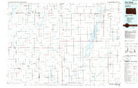
1985 Map of Elm River
USGS Topo · Published 1985About this map
The Sand Lake National Wildlife Refuge dominates the eastern drainage of this mid-1980s landscape, where the James River and Sand Lake Reservoir create a vital corridor for migratory birds. This region, spanning the border between North Dakota and South Dakota, is characterized by its organized agricultural colonies and water management systems. Numerous flowing wells dot the prairies near settlements such as Frederick and Hecla, while communal living is evidenced by the Spring Creek Colony, Long Lake Colony, and Plainview Colony No 2.
Find a feature on this map
65 named features on this map. Tap any name to fly to it.
Don’t see what you’re looking for? This feature index may not catch every label — zoom into the map to look around manually.
Map Details
Editions of this 1985 Elm River Map
2 editions found
Other maps of this area

1894 · Monango
USGS Topo · 1:62,500

1894 · Ellendale
USGS Topo · 1:62,500

1894 · Hecla
USGS Topo · 1:62,500

1894 · Columbia
USGS Topo · 1:62,500

1894 · Savo
USGS Topo · 1:62,500

1894 · Fullerton
USGS Topo · 1:62,500

1894 · Oakes
USGS Topo · 1:62,500

1895 · Lamoure
USGS Topo · 1:125,000

1895 · Aberdeen
USGS Topo · 1:125,000

1896 · Columbia
USGS Topo · 1:125,000