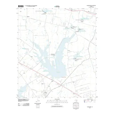
2010 Map of Elmendorf
USGS Topo · Published 2010About this map
Calaveras Lake and the nearby Victor Braunig Lake anchor this 2010 study of the landscape south of San Antonio. The area is dominated by an extensive network of water management infrastructure, including numerous soil conservation sites such as Soil Conservation Service Site 9 Reservoir and several dams along Calaveras Creek. This system of reservoirs and dams supports the local utility infrastructure, most notably the O W Somerset-JT Deely-J K Spruce Generating Complex situated along the western shore of the main lake.
Find a feature on this map
71 named features on this map. Tap any name to fly to it.
Don’t see what you’re looking for? This feature index may not catch every label — zoom into the map to look around manually.
Map Details
Editions of this 2010 Elmendorf Map
This is the sole edition of this map. No revisions or reprints were ever made.
Other maps of this area

1936 · Floresville
USGS Topo · 1:62,500

1953 · San Antonio East
USGS Topo · 1:24,000

1953 · Elmendorf
USGS Topo · 1:24,000

1953 · Southton
USGS Topo · 1:24,000

1953 · Martinez
USGS Topo · 1:24,000

1954 · San Antonio
USGS Topo · 1:250,000

1957 · San Antonio
USGS Topo · 1:250,000

1958 · Losoya
USGS Topo · 1:24,000

1958 · La Vernia SW
USGS Topo · 1:24,000

1958 · Saspamco
USGS Topo · 1:24,000