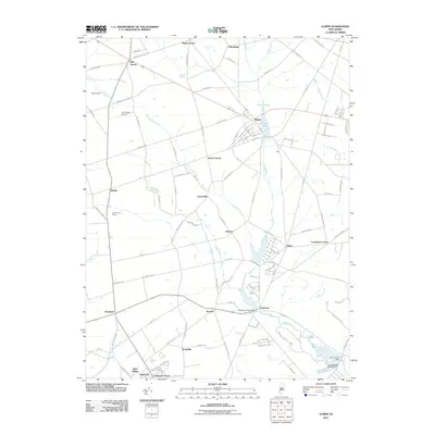
2011 Map of Elmer
USGS Topo · Published 2011About this map
Elmer serves as a central hub for this corner of South Jersey, where a grid of rural roads connects established agricultural communities. The landscape is defined by the drainage of Muddy Run, which feeds into Elmer Lake and continues south past Centerton. To the southwest, the industrial scale of agriculture is evident at Seabrook Farms and Larchmont Farms, reflecting a legacy of large-scale food production and processing in the region. Smaller crossroad settlements like Pole Tavern, Shirley, and Palatine dot the map, marking historic junctions. Aviation history is represented by Emmanuel Airport, tucked between the Palatine Branch and Newkirk Station Rd. The southern edge of the sheet transitions into preserved waterways and recreation areas, including Thundergust Lake and several water-control structures like Sadies Dam.
Find a feature on this map
99 named features on this map. Tap any name to fly to it.
Don’t see what you’re looking for? This feature index may not catch every label — zoom into the map to look around manually.
Map Details
Editions of this 2011 Elmer Map
This is the sole edition of this map. No revisions or reprints were ever made.
Other maps of this area

1890 · Salem
USGS Topo · 1:62,500

1890 · Bay Side
USGS Topo · 1:62,500

1890 · Bridgeton
USGS Topo · 1:62,500

1890 · Glassboro
USGS Topo · 1:62,500

1894 · Bay Side
USGS Topo · 1:62,500

1894 · Bridgeton
USGS Topo · 1:62,500

1898 · Salem
USGS Topo · 1:62,500

1898 · Glassboro
USGS Topo · 1:62,500

1899 · Vineland
USGS Topo · 1:125,000

1901 · Camden
USGS Topo · 1:125,000
Featured Places
- Deerfield, Upper Deerfield Township
- Alloway Township, NJ
- Elmer, NJ
- Upper Pittsgrove Township, NJ
- Seabrook, Upper Deerfield Township