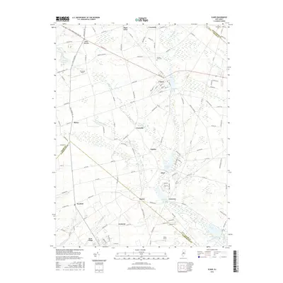
2016 Map of Elmer
USGS Topo · Published 2016About this map
The town of Elmer serves as a central hub for this portion of southern New Jersey, where the intersection of Chestnut St and Bridgeton Pike anchors a landscape of agricultural fields and water systems. The map traces the hydrological networks of the Salem River and Muddy Run, which feed into several significant local water bodies including Elmer Lake, Palatine Lake, and Centerton Pond. These waterways historically supported the early industry and settlement of villages like Centerton, Olivet, and Palatine.
Find a feature on this map
124 named features on this map. Tap any name to fly to it.
Don’t see what you’re looking for? This feature index may not catch every label — zoom into the map to look around manually.
Map Details
Editions of this 2016 Elmer Map
This is the sole edition of this map. No revisions or reprints were ever made.
Other maps of this area

1890 · Salem
USGS Topo · 1:62,500

1890 · Bay Side
USGS Topo · 1:62,500

1890 · Bridgeton
USGS Topo · 1:62,500

1890 · Glassboro
USGS Topo · 1:62,500

1894 · Bay Side
USGS Topo · 1:62,500

1894 · Bridgeton
USGS Topo · 1:62,500

1898 · Salem
USGS Topo · 1:62,500

1898 · Glassboro
USGS Topo · 1:62,500

1899 · Vineland
USGS Topo · 1:125,000

1901 · Camden
USGS Topo · 1:125,000
Featured Places
- Deerfield, Upper Deerfield Township
- Alloway Township, NJ
- Elmer, NJ
- Upper Pittsgrove Township, NJ
- Seabrook, Upper Deerfield Township