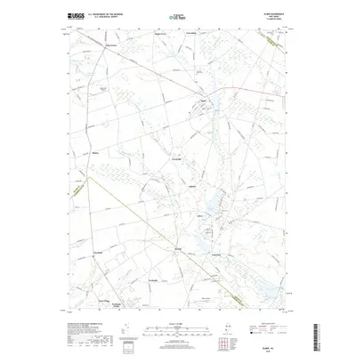
2019 Map of Elmer
USGS Topo · Published 2019About this map
The borough of Elmer sits at the northern end of this South Jersey landscape, where local roads like Chestnut St and Pole Tavern Woodstown Rd converge. This 2019 survey documents a region defined by its rural heritage and water systems, including the Salem River Reservoir and Palatine Lake. Historically significant settlements such as Pole Tavern, Husted, and Centerton are mapped alongside the extensive agricultural operations of Seabrook Farms near the southern border. Genealogists will find the locations of Chestnut Grove Cem and Olivet Cem helpful for tracing family roots. The map also captures the transition between Salem and Cumberland counties, following a geography shaped by numerous waterways including Indian Run, Muddy Run, and Parsonage Run.
Find a feature on this map
125 named features on this map. Tap any name to fly to it.
Don’t see what you’re looking for? This feature index may not catch every label — zoom into the map to look around manually.
Map Details
Editions of this 2019 Elmer Map
This is the sole edition of this map. No revisions or reprints were ever made.
Other maps of this area

1890 · Salem
USGS Topo · 1:62,500

1890 · Bay Side
USGS Topo · 1:62,500

1890 · Bridgeton
USGS Topo · 1:62,500

1890 · Glassboro
USGS Topo · 1:62,500

1894 · Bay Side
USGS Topo · 1:62,500

1894 · Bridgeton
USGS Topo · 1:62,500

1898 · Salem
USGS Topo · 1:62,500

1898 · Glassboro
USGS Topo · 1:62,500

1899 · Vineland
USGS Topo · 1:125,000

1901 · Camden
USGS Topo · 1:125,000
Featured Places
- Deerfield, Upper Deerfield Township
- Alloway Township, NJ
- Elmer, NJ
- Upper Pittsgrove Township, NJ
- Seabrook, Upper Deerfield Township