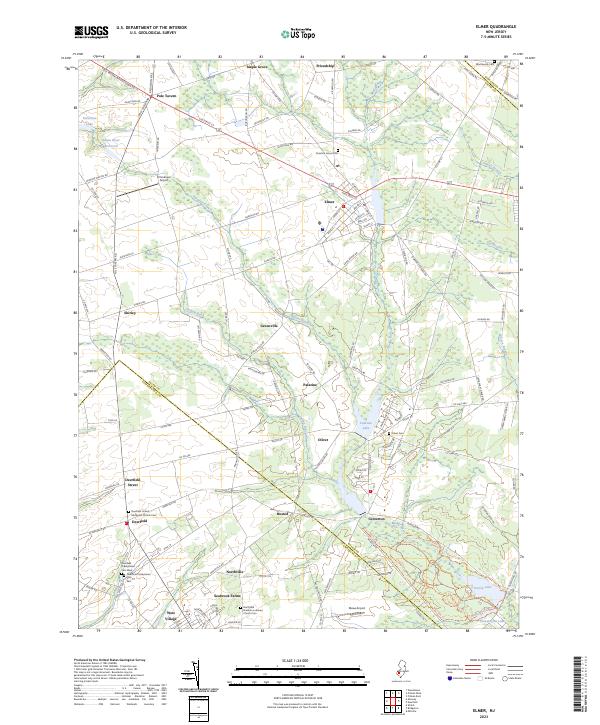
2023 Map of Elmer
USGS Topo · Published 2023About this map
Elmer serves as a central hub for this rural portion of South Jersey, where agricultural patterns meet the upper reaches of the Salem River Reservoir. The landscape is defined by its transition between Salem Co and Cumberland Co, with numerous historic crossroads such as Pole Tavern and Shirley dotting the western half of the map. In the southern reaches, the presence of Seabrook Farms and Northville points to the area's deep-rooted industrial farming heritage, while the Northville Estonian Lutheran Church Cem and multiple Deerfield cemeteries provide specific points of interest for genealogical research.
Find a feature on this map
142 named features on this map. Tap any name to fly to it.
Don’t see what you’re looking for? This feature index may not catch every label — zoom into the map to look around manually.
Map Details
Editions of this 2023 Elmer Map
This is the sole edition of this map. No revisions or reprints were ever made.
Other maps of this area

1890 · Salem
USGS Topo · 1:62,500

1890 · Bay Side
USGS Topo · 1:62,500

1890 · Bridgeton
USGS Topo · 1:62,500

1890 · Glassboro
USGS Topo · 1:62,500

1894 · Bay Side
USGS Topo · 1:62,500

1894 · Bridgeton
USGS Topo · 1:62,500

1898 · Salem
USGS Topo · 1:62,500

1898 · Glassboro
USGS Topo · 1:62,500

1899 · Vineland
USGS Topo · 1:125,000

1901 · Camden
USGS Topo · 1:125,000
Featured Places
- Deerfield, Upper Deerfield Township
- Alloway Township, NJ
- Elmer, NJ
- Friendship, Upper Pittsgrove Township
- Deerfield Township, NJ