
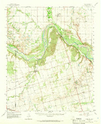
1958 Map of Elmer
USGS Topo · Published 1960About this map
The Red River defines the winding border between Oklahoma and Texas, where the Salt Fork Red River joins it amidst a landscape of riverine sandbars and open Ranchland. In the late 1950s, this region was a nexus of agriculture and industry, dominated by the Fargo Oil Field and the nearby Amerada Camp. Small prairie settlements like Elmer, Hess, and Odell are connected by a network of section-line roads and the tracks of the A T & S F railroad.
Find a feature on this map
34 named features on this map. Tap any name to fly to it.
Don’t see what you’re looking for? This feature index may not catch every label — zoom into the map to look around manually.
Map Details
Editions of this 1958 Elmer Map
2 editions found
Other maps of this area

1955 · Lawton
USGS Topo · 1:250,000

1958 · Davidson
USGS Topo · 1:62,500

1958 · Frederick
USGS Topo · 1:62,500

1958 · Vernon
USGS Topo · 1:62,500

1958 · Medicine Mound
USGS Topo · 1:62,500

1960 · Quanah
USGS Topo · 1:62,500

1963 · Altus SE
USGS Topo · 1:24,000

1964 · Tipton
USGS Topo · 1:24,000

1964 · Olustee
USGS Topo · 1:24,000

1971 · Prairie Hill
USGS Topo · 1:24,000