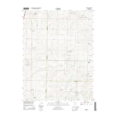
2014 Map of Elmira
USGS Topo · Published 2014About this map
Elmira and Mirabile anchor this rural landscape where the borders of Clinton, Caldwell, and Ray counties converge. The terrain is defined by the winding course of the Crooked River and its various tributaries, including the S Prong Crooked River and Brushy Cr. This 2014 survey reveals a region deeply tied to its local heritage, evidenced by a high density of family and community burial grounds such as Deer Creek Cemetery, Sloan Cemetery, and Zeikle Cemetery. Small settlements like Plainview, Prairie Ridge, and Barnesville are scattered across the township lines of T56N, T55N, and T54N. The presence of Martins Airport near Elmira and several small water bodies, including Garden City Lake and Pallas Lake, suggests a mix of agricultural land use and local recreational aviation in this northwestern Missouri interior.
Find a feature on this map
91 named features on this map. Tap any name to fly to it.
Don’t see what you’re looking for? This feature index may not catch every label — zoom into the map to look around manually.
Map Details
Editions of this 2014 Elmira Map
This is the sole edition of this map. No revisions or reprints were ever made.
Other maps of this area

1894 · Independence
USGS Topo · 1:125,000

1924 · Polo
USGS Topo · 1:62,500

1925 · Plattsburg
USGS Topo · 1:62,500

1936 · Kearney
USGS Topo · 1:48,000

1942 · Kearney
USGS Topo · 1:62,500

1945 · Kearney
USGS Topo · 1:62,500

1950 · Kansas City
USGS Topo · 1:250,000

1954 · Kansas City
USGS Topo · 1:250,000

1956 · Kansas City
USGS Topo · 1:250,000
1957 · Knoxville
USGS Topo · 1:24,000