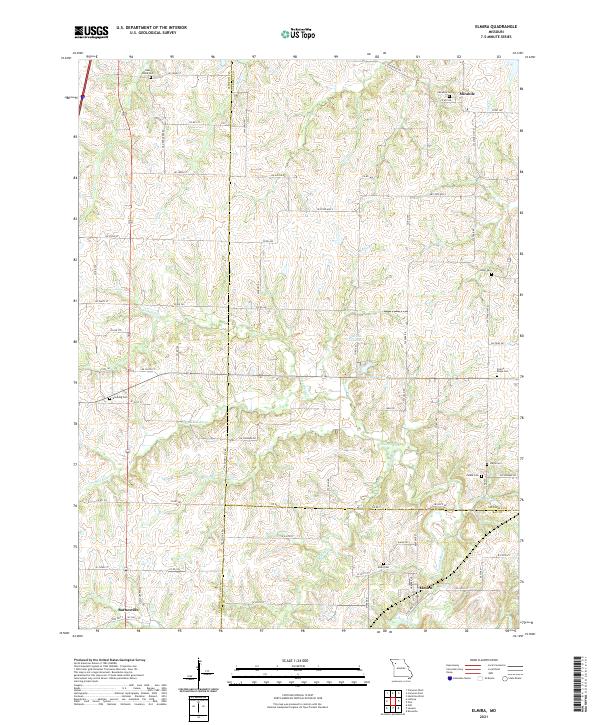
2021 Map of Elmira
USGS Topo · Published 2021About this map
Mirabile and Elmira anchor this agricultural landscape at the intersection of Clinton, Caldwell, and Ray counties. The terrain is defined by the winding course of the Crooked River and its many tributaries, including the S Prong Crooked River and Brushy Cr. For genealogists, the map is a significant resource, precisely locating several family and community burial grounds such as Sloan Cem, Cates Cem, and Allen Cem. The presence of Garden City Lake and Timber Lake alongside established township roads like Tri-County Line Rd illustrates a rural Missouri environment where water management and local transit have shaped settlement patterns over generations. The surveyor's detail captures a quiet regional hub, showing the transition from the small village of Barnesville in the southwest to the upland reaches near Tub Cr in the northeast.
Find a feature on this map
82 named features on this map. Tap any name to fly to it.
Don’t see what you’re looking for? This feature index may not catch every label — zoom into the map to look around manually.
Map Details
Editions of this 2021 Elmira Map
This is the sole edition of this map. No revisions or reprints were ever made.
Other maps of this area

1894 · Independence
USGS Topo · 1:125,000

1924 · Polo
USGS Topo · 1:62,500

1925 · Plattsburg
USGS Topo · 1:62,500

1936 · Kearney
USGS Topo · 1:48,000

1942 · Kearney
USGS Topo · 1:62,500

1945 · Kearney
USGS Topo · 1:62,500

1950 · Kansas City
USGS Topo · 1:250,000

1954 · Kansas City
USGS Topo · 1:250,000

1956 · Kansas City
USGS Topo · 1:250,000
1957 · Knoxville
USGS Topo · 1:24,000