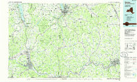
1986 Map of Elmira
USGS Topo · Published 1986About this map
The Chemung River and Susquehanna River define the industrial and residential corridors of this southern New York and northern Pennsylvania border region. In the mid-1980s, the valley floors are densely settled from Elmira through Horseheads, while the eastern reaches show the sprawling footprint of Endicott and Vestal near the confluence with the Tioughnioga River. The map highlights the significant academic presence in the north at Ithaca, where the campuses of Cornell University and Ithaca College overlook the southern tip of the Finger Lakes region.
Find a feature on this map
209 named features on this map. Tap any name to fly to it.
Don’t see what you’re looking for? This feature index may not catch every label — zoom into the map to look around manually.
Map Details
Editions of this 1986 Elmira Map
This is the sole edition of this map. No revisions or reprints were ever made.
Other maps of this area

1893 · Ithaca
USGS Topo · 1:62,500

1895 · Ithaca
USGS Topo · 1:62,500

1895 · Elmira
USGS Topo · 1:62,500

1898 · Moravia
USGS Topo · 1:62,500

1898 · Watkins Glen
USGS Topo · 1:62,500

1900 · Tioga
USGS Topo · 1:62,500

1900 · Dryden
USGS Topo · 1:62,500

1901 · Apalachin
USGS Topo · 1:62,500

1901 · Watkins
USGS Topo · 1:62,500

1902 · Waverly
USGS Topo · 1:62,500