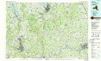
1992 Map of Elmira
USGS Topo · Published 1993About this map
The southern Finger Lakes region and the industrial valleys of the Southern Tier are documented here during the early 1990s, anchored by the urban centers of Elmira and Ithaca. The landscape is defined by the dramatic glacial troughs of Seneca Lake and Cayuga Lake, which dominate the northern portion of the map. These deep waters are surrounded by a high-elevation plateau marked by family-named landmarks like Beam Hill, Connecticut Hill, and Quackenbush Hill. The Southern Tier's development follows the winding paths of the Chemung River and Susquehanna River, where towns like Owego, Waverly, and Sayre grew alongside the Conrail rail lines.
Find a feature on this map
277 named features on this map. Tap any name to fly to it.
Don’t see what you’re looking for? This feature index may not catch every label — zoom into the map to look around manually.
Map Details
Editions of this 1992 Elmira Map
This is the sole edition of this map. No revisions or reprints were ever made.
Other maps of this area

1893 · Ithaca
USGS Topo · 1:62,500

1895 · Ithaca
USGS Topo · 1:62,500

1895 · Elmira
USGS Topo · 1:62,500

1898 · Moravia
USGS Topo · 1:62,500

1898 · Watkins Glen
USGS Topo · 1:62,500

1900 · Tioga
USGS Topo · 1:62,500

1900 · Dryden
USGS Topo · 1:62,500

1901 · Apalachin
USGS Topo · 1:62,500

1901 · Watkins
USGS Topo · 1:62,500

1902 · Waverly
USGS Topo · 1:62,500