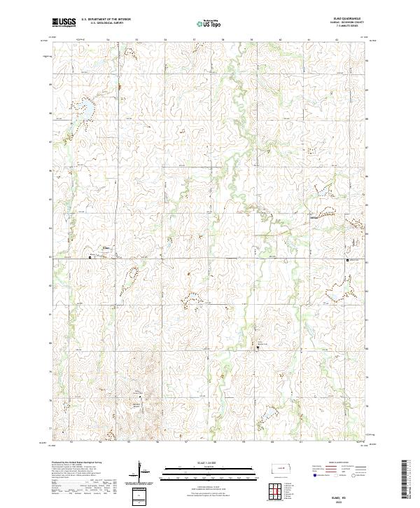
2022 Map of Elmo
USGS Topo · Published 2022About this map
Elmo and Dillon anchor this central Kansas landscape, a region defined by the intricate drainage of Turkey Cr and its various forks. The terrain is structured by a meticulous grid of rural avenues and roads, including Gulf Rd and Jeep Rd, which connect scattered homesteads and local landmarks. Genealogists will find several burial grounds across these townships, such as Banner Cem near Elmo and Ashton Cem to the east. The presence of Barnard Airport near Mount Calvary Cem suggests the continued importance of small-scale aviation in this agricultural heartland. The mapping of W Br Turkey Cr, W Turkey Cr, and E Turkey Cr illustrates how these waterways dictate the local topography, carving shallow valleys through the surrounding prairie.
Find a feature on this map
30 named features on this map. Tap any name to fly to it.
Don’t see what you’re looking for? This feature index may not catch every label — zoom into the map to look around manually.
Map Details
Editions of this 2022 Elmo Map
This is the sole edition of this map. No revisions or reprints were ever made.
Other maps of this area

1889 · Abilene
USGS Topo · 1:125,000

1894 · Abilene
USGS Topo · 1:125,000

1955 · Hutchinson
USGS Topo · 1:250,000

1959 · Hutchinson
USGS Topo · 1:250,000

1963 · Abilene SW
USGS Topo · 1:24,000
1963 · Holland
USGS Topo · 1:24,000

1964 · Elmo
USGS Topo · 1:24,000

1964 · Carlton
USGS Topo · 1:24,000

1964 · Ramona
USGS Topo · 1:24,000

1964 · Navarre
USGS Topo · 1:24,000