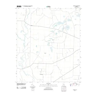
2011 Map of Elmodel
USGS Topo · Published 2011About this map
Hawkinstown and Elmodel anchor this southwestern Georgia landscape, where agricultural land is defined by a unique network of lime sinks and seasonal ponds. The hydrology of the area is dominated by the winding paths of Chickasawhatchee Creek and Ichawaynochaway Creek, which create natural boundaries between the grid of rural roads. These water bodies often bear names reflecting local utility and community traditions, such as Ginhouse Pond and Baptizing Pond, while the presence of Grassy Flat and Richardson Flat indicates the characteristic low-lying terrain of the region.
Find a feature on this map
42 named features on this map. Tap any name to fly to it.
Don’t see what you’re looking for? This feature index may not catch every label — zoom into the map to look around manually.
Map Details
Editions of this 2011 Elmodel Map
This is the sole edition of this map. No revisions or reprints were ever made.
Other maps of this area

1953 · Dothan
USGS Topo · 1:250,000

1954 · Dothan
USGS Topo · 1:250,000

1955 · Dothan
USGS Topo · 1:250,000

1956 · Newton
USGS Topo · 1:62,500

1971 · Hopeful
USGS Topo · 1:24,000
1971 · Branchville
USGS Topo · 1:24,000

1974 · Cooktown
USGS Topo · 1:24,000

1974 · Elmodel
USGS Topo · 1:24,000
1974 · Newton
USGS Topo · 1:24,000
1974 · Leary
USGS Topo · 1:24,000