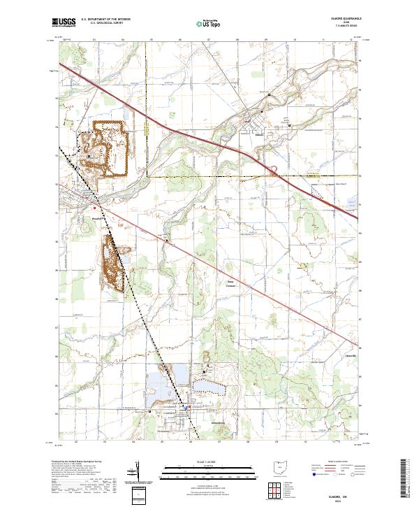
2023 Map of Elmore
USGS Topo · Published 2023About this map
The Portage River winds through the heart of northern Ohio, connecting the established communities of Elmore and Woodville along the border of Ottawa and Sandusky counties. This landscape is defined by its agricultural roots and deep community history, anchored by the Sandusky County Courthouse District Number Two. The map details a dense network of township and county roads, such as S Opfer-Lentz Rd and Damschroder Rd, which link the main towns to outlying hamlets like Busy Corners, Gibsonburg, and Hessville. Genealogy and local history researchers will find a significant concentration of burial sites, including Harris-Elmore Union Cem and Saint Lawrence Cem, which serve as markers for the area's ancestral settlement patterns. Water features like Sugar Creek and Wolf Creek shape the drainage of this fertile terrain, while the inclusion of Haar Airport and Aldrich Pond highlights modern infrastructure and local recreation points.
Find a feature on this map
115 named features on this map. Tap any name to fly to it.
Don’t see what you’re looking for? This feature index may not catch every label — zoom into the map to look around manually.
Map Details
Editions of this 2023 Elmore Map
This is the sole edition of this map. No revisions or reprints were ever made.
Other maps of this area

1900 · Maumee Bay
USGS Topo · 1:62,500

1900 · Oak Harbor
USGS Topo · 1:62,500

1901 · Fremont
USGS Topo · 1:62,500

1901 · Elmore
USGS Topo · 1:62,500

1903 · Fremont
USGS Topo · 1:62,500

1903 · Elmore
USGS Topo · 1:62,500

1935 · Walbridge
USGS Topo · 1:24,000

1935 · Genoa
USGS Topo · 1:24,000

1938 · Walbridge
USGS Topo · 1:31,680
1938 · Genoa
USGS Topo · 1:31,680