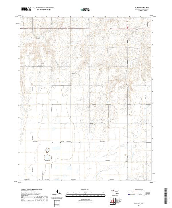
2022 Map of Elmwood
USGS Topo · Published 2022About this map
The small community of Elmwood serves as the focal point of this high-plains landscape in Beaver County, Oklahoma. This modern survey illustrates the enduring township-and-range grid system that defines the region's agricultural and social organization, with roads like Ew-29 and NS-138 forming the primary skeleton for travel across the terrain. While the landscape is characterized by its broad expanses, the drainage patterns of Duck Pond Cr and S Fork Clear Cr introduce significant topographical variation, carving numerous named features such as Hollow E0330 and Hollow N1350 into the plains. Genealogists and local historians will find the Kirby Cem located south of the main settlement, providing a critical reference point for family history in this corner of the Panhandle. The map captures the intersection of ranching infrastructure and natural watercourses that have historically dictated the placement of homesteads and crossroads in this arid environment.
Find a feature on this map
46 named features on this map. Tap any name to fly to it.
Don’t see what you’re looking for? This feature index may not catch every label — zoom into the map to look around manually.
Map Details
Editions of this 2022 Elmwood Map
This is the sole edition of this map. No revisions or reprints were ever made.
Other maps of this area

1954 · Perryton
USGS Topo · 1:250,000

1958 · Perryton
USGS Topo · 1:250,000

1971 · Clear Lake NW
USGS Topo · 1:24,000

1971 · Clear Lake SW
USGS Topo · 1:24,000

1972 · Gaylord
USGS Topo · 1:24,000

1973 · Booker
USGS Topo · 1:24,000

1973 · Balko
USGS Topo · 1:24,000

1973 · Balko NE
USGS Topo · 1:24,000

1973 · Elmwood
USGS Topo · 1:24,000

1973 · Balko SW
USGS Topo · 1:24,000