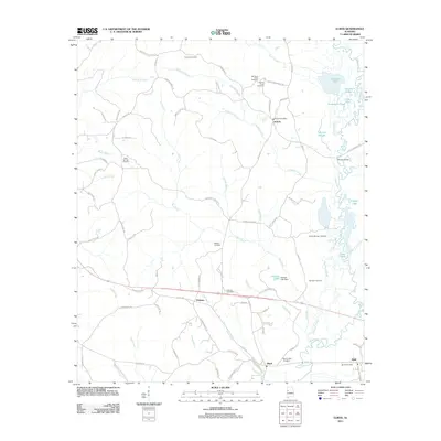
2011 Map of Elrod
USGS Topo · Published 2011About this map
The Sipsey River meanders along the eastern edge of this Alabama landscape, creating a wetland environment defined by Springer Slough and Cooper Slough. Small agricultural and residential communities like Echola, Holman, and Elrod are connected by a network of county roads, such as Co Rd 140 and Carrollton Rd. The area is notably dense with family and community burial grounds, including the Mount Nebo Cemetery, Corinth Cemetery, and Freeman Cemetery, which provide significant points of interest for genealogical research in western Tuscaloosa County.
Find a feature on this map
89 named features on this map. Tap any name to fly to it.
Don’t see what you’re looking for? This feature index may not catch every label — zoom into the map to look around manually.
Map Details
Editions of this 2011 Elrod Map
This is the sole edition of this map. No revisions or reprints were ever made.
Other maps of this area

1924 · Tuscaloosa
USGS Topo · 1:62,500

1926 · Samantha
USGS Topo · 1:48,000

1926 · Tuscaloosa
USGS Topo · 1:62,500

1928 · Samantha
USGS Topo · 1:62,500

1953 · Birmingham
USGS Topo · 1:250,000

1956 · Birmingham
USGS Topo · 1:250,000

1957 · Birmingham
USGS Topo · 1:250,000

1967 · Brownville
USGS Topo · 1:24,000

1967 · Gordo
USGS Topo · 1:24,000
1967 · Palmetto
USGS Topo · 1:24,000