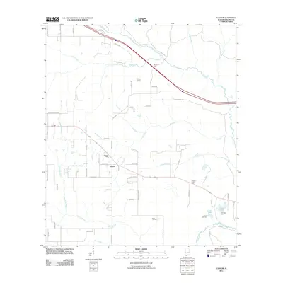
2011 Map of Elsanor
USGS Topo · Published 2011About this map
The Styx River winds through the northern reaches of this Baldwin County landscape, providing a natural drainage for numerous tributaries like Cowpen Creek and Beetree Creek. Centered on the settlement of Elsanor, the area is characterized by a network of rural roads such as Heidelberg Rd and Cowpen Creek Rd that connect family landmarks and local heritage sites. Genealogists may find interest in the documented locations of Foley Cemetery and Creek Cemetery, while the presence of the Seminole Lookout Tower in the southeast reflects the region's managed timberlands. To the south, the Blackwater River and its associated water bodies, including Cook Lake and Pace Lake, define the local hydrography. The inclusion of features like Wallace Field and Taylors Camp suggests a landscape shaped by both agriculture and seasonal recreation near the riverbanks.
Find a feature on this map
71 named features on this map. Tap any name to fly to it.
Don’t see what you’re looking for? This feature index may not catch every label — zoom into the map to look around manually.
Map Details
Editions of this 2011 Elsanor Map
This is the sole edition of this map. No revisions or reprints were ever made.
Other maps of this area

1920 · Robertsdale
USGS Topo · 1:62,500

1921 · Bon Secour
USGS Topo · 1:62,500

1921 · Fort Barrancas
USGS Topo · 1:62,500

1921 · Muscogee
USGS Topo · 1:62,500

1941 · Fort Barrancas
USGS Topo · 1:62,500

1941 · Muscogee
USGS Topo · 1:62,500

1941 · Robertsdale
USGS Topo · 1:62,500

1941 · Foley
USGS Topo · 1:62,500

1943 · Robertsdale
USGS Topo · 1:62,500

1943 · Muscogee
USGS Topo · 1:62,500