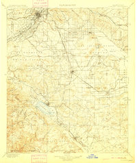
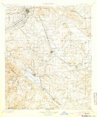
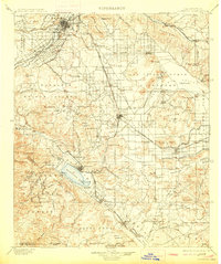
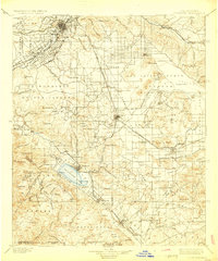
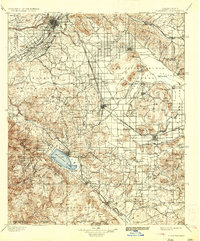
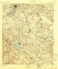
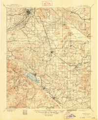
1901 Map of Elsinore
USGS Topo · Published 1909About this map
The Santa Ana River flows through the northern reaches of this territory, anchoring a landscape where emerging citrus agriculture and heavy mining intersected at the turn of the century. Irrigation infrastructure like the Gage Canal and arterial routes such as Magnolia Avenue reflect the planned growth of Riverside, while the southern regions remain dominated by the expansive Elsinore Lake and the San Jacinto Valley.
Find a feature on this map
111 named features on this map. Tap any name to fly to it.
Don’t see what you’re looking for? This feature index may not catch every label — zoom into the map to look around manually.
Map Details
Editions of this 1901 Elsinore Map
8 editions found
Other maps of this area

1896 · San Bernardino
USGS Topo · 1:62,500

1897 · Cucamonga
USGS Topo · 1:62,500

1898 · San Bernardino
USGS Topo · 1:62,500

1899 · Redlands
USGS Topo · 1:62,500

1900 · Cucamonga
USGS Topo · 1:62,500

1901 · Southern California Sheet No. 1
USGS Topo · 1:250,000

1901 · San Jacinto
USGS Topo · 1:125,000

1901 · San Bernardino
USGS Topo · 1:62,500

1901 · Redlands
USGS Topo · 1:62,500

1901 · Elsinore
USGS Topo · 1:125,000