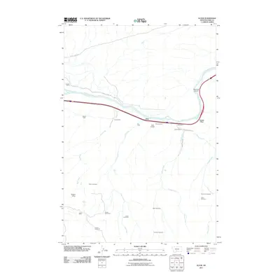
2011 Map of Elton
USGS Topo · Published 2011About this map
The Yellowstone River cuts a wide path through this portion of Park County, Montana, serving as the primary geographic corridor for both transportation and settlement. Following the river's northern bank, Convict Grade Rd traces the base of the bluffs near McAdows Canyon, while the main valley floor is marked by a series of long-established ranching and residential sites. The settlement at Elton sits centrally along the river, flanked by various operations such as Swanson Ranch, Peterson Ranch, and the L M Lodge.
Find a feature on this map
28 named features on this map. Tap any name to fly to it.
Don’t see what you’re looking for? This feature index may not catch every label — zoom into the map to look around manually.
Map Details
Editions of this 2011 Elton Map
This is the sole edition of this map. No revisions or reprints were ever made.
Other maps of this area

1891 · Livingston
USGS Topo · 1:250,000

1893 · Livingston
USGS Topo · 1:250,000

1947 · Bozeman
USGS Topo · 1:250,000

1948 · Bozeman
USGS Topo · 1:250,000

1951 · Mount Rae
USGS Topo · 1:24,000

1951 · Grannis
USGS Topo · 1:24,000

1951 · Kelly Hills
USGS Topo · 1:24,000

1951 · Livingston Peak
USGS Topo · 1:24,000

1951 · Springdale
USGS Topo · 1:24,000

1951 · Mc Leod Basin
USGS Topo · 1:24,000