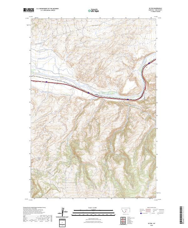
2024 Map of Elton
USGS Topo · Published 2024About this map
The Yellowstone River cuts through this portion of Park County, Montana, serving as the central axis for both natural drainage and human engineering. The settlement at Elton sits along the river's path, flanked by a sophisticated network of irrigation systems including the Upper Windsor Ditch, Middle Windsor Ditch, and Lower Windsor Ditch. These diversions, along with the Big Mission Ditch, underscore the agricultural necessity of water management in the high plains environment.
Find a feature on this map
25 named features on this map. Tap any name to fly to it.
Don’t see what you’re looking for? This feature index may not catch every label — zoom into the map to look around manually.
Map Details
Editions of this 2024 Elton Map
This is the sole edition of this map. No revisions or reprints were ever made.
Other maps of this area

1891 · Livingston
USGS Topo · 1:250,000

1893 · Livingston
USGS Topo · 1:250,000

1947 · Bozeman
USGS Topo · 1:250,000

1948 · Bozeman
USGS Topo · 1:250,000

1951 · Mount Rae
USGS Topo · 1:24,000

1951 · Grannis
USGS Topo · 1:24,000

1951 · Kelly Hills
USGS Topo · 1:24,000

1951 · Livingston Peak
USGS Topo · 1:24,000

1951 · Springdale
USGS Topo · 1:24,000

1951 · Mc Leod Basin
USGS Topo · 1:24,000