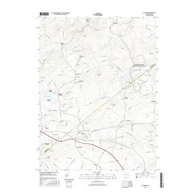
2016 Map of Elverson
USGS Topo · Published 2016About this map
Hopewell Furnace National Historic Site serves as a focal point for this landscape along the border of Berks and Chester Counties. This survey reveals a complex network of early industrial sites and rural settlements, including Scarlets Mill and the crossroads at Geigertown and Elverson. The terrain is defined by prominent elevations such as Long Mtn and Welsh Mtn, while the Birdsboro Reservoir and Hopewell Lake provide significant water features. Genealogists will find numerous burial grounds, including Saint Pauls United Methodist Church Cem and Morningside Cem. The transition from the high ground of Mtn Pleasure down to the Pine Swamp and the headwaters of French Cr illustrates the varied topography of this corner of the Pennsylvania Piedmont.
Find a feature on this map
139 named features on this map. Tap any name to fly to it.
Don’t see what you’re looking for? This feature index may not catch every label — zoom into the map to look around manually.
Map Details
Editions of this 2016 Elverson Map
This is the sole edition of this map. No revisions or reprints were ever made.
Other maps of this area

1894 · Reading
USGS Topo · 1:62,500

1902 · Boyertown
USGS Topo · 1:62,500

1905 · Honey Brook
USGS Topo · 1:62,500

1906 · Phoenixville
USGS Topo · 1:62,500

1907 · Honeybrook
USGS Topo · 1:62,500

1913 · Reading
USGS Topo · 1:62,500

1915 · Reading
USGS Topo · 1:62,500

1941 · Honeybrook
USGS Topo · 1:62,500
1943 · Boyertown
USGS Topo · 1:31,680
1943 · Phoenixville
USGS Topo · 1:62,500
Featured Places
- Warwick Township, PA
- East Nantmeal Township, PA
- Elverson, PA
- Cold Run, Robeson Township
- Loag, West Nantmeal Township