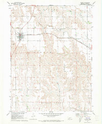
1971 Map of Elwood
USGS Topo · Published 1973About this map
Elwood serves as the primary hub of this Gosper County landscape, situated along the Burlington Northern railroad corridor. The terrain is defined by the headwaters of the Turkey Creek drainage system, specifically the West Branch Turkey Creek and East Branch Turkey Creek, which carve deep, intricate coulees into the southern half of the quadrangle. This 1971 field check captures the town's infrastructure, including the Sewage Disposal plant and a prominent Radio Tower.
Find a feature on this map
21 named features on this map. Tap any name to fly to it.
Don’t see what you’re looking for? This feature index may not catch every label — zoom into the map to look around manually.
Map Details
Editions of this 1971 Elwood Map
2 editions found
Other maps of this area

1896 · Lexington
USGS Topo · 1:125,000

1896 · Arapahoe
USGS Topo · 1:125,000

1898 · Arapahoe
USGS Topo · 1:125,000

1899 · Lexington
USGS Topo · 1:125,000

1955 · Grand Island
USGS Topo · 1:250,000

1957 · Grand Island
USGS Topo · 1:250,000

1958 · Grand Island
USGS Topo · 1:250,000

1962 · Bertrand NW
USGS Topo · 1:24,000
1971 · Arapahoe NE
USGS Topo · 1:24,000
1971 · Johnson Lake
USGS Topo · 1:24,000