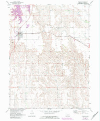
1971 Map of Elwood
USGS Topo · Published 1983About this map
The town of Elwood serves as the focal point of this Gosper County landscape, where the agricultural plains are punctuated by the sprawling fingers of the Elwood Reservoir. This high-plains geography is defined by the sharp transition between level farming sections and the erosion-carved breaks of Devils Gap. The infrastructure of the early 1970s is clearly visible, showing the Burlington Northern railroad corridor running parallel to local routes like E-65. Water management and drainage are central to the area's layout, with Plum Creek trending northeast while the West Branch Turkey Creek and East Branch Turkey Creek head south. For those tracing family histories in the region, the map identifies local landmarks such as Elwood Cem and the Quakerville Cem, providing precise locations for these community sites within the larger township grid.
Find a feature on this map
12 named features on this map. Tap any name to fly to it.
Don’t see what you’re looking for? This feature index may not catch every label — zoom into the map to look around manually.
Map Details
Editions of this 1971 Elwood Map
2 editions found
Other maps of this area

1896 · Lexington
USGS Topo · 1:125,000

1896 · Arapahoe
USGS Topo · 1:125,000

1898 · Arapahoe
USGS Topo · 1:125,000

1899 · Lexington
USGS Topo · 1:125,000

1955 · Grand Island
USGS Topo · 1:250,000

1957 · Grand Island
USGS Topo · 1:250,000

1958 · Grand Island
USGS Topo · 1:250,000

1962 · Bertrand NW
USGS Topo · 1:24,000
1971 · Arapahoe NE
USGS Topo · 1:24,000
1971 · Johnson Lake
USGS Topo · 1:24,000