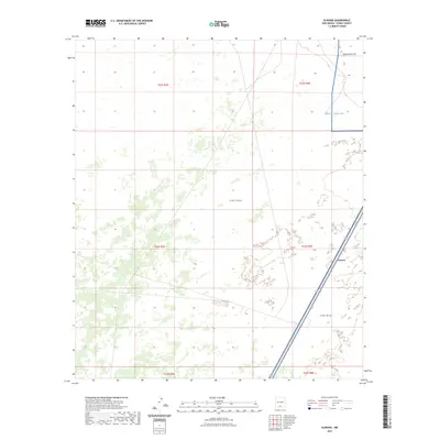
2023 Map of Elwood
USGS Topo · Published 2023About this map
The settlement of Elwood anchors the eastern edge of this 2023 survey in Otero County, where desert scrub meets military reservation boundaries. Much of the quadrangle is defined by the expansive presence of Fort Bliss, reflecting the deep integration of military land use in the New Mexico landscape. The terrain rises to Rattlesnake Hill in the northeast, a notable topographic feature overlooking the arid flats below. Water management in this dry region is evidenced by the inclusion of McNew South Tank, a essential piece of cattle-ranching or wildlife infrastructure typical of the Tularosa Basin's edges. The map provides a clear view of the sparse road network and township boundaries, including t23s r8e and t24s r8e, illustrating the intersection of private and federal lands in the modern era.
Find a feature on this map
10 named features on this map. Tap any name to fly to it.
Don’t see what you’re looking for? This feature index may not catch every label — zoom into the map to look around manually.
Map Details
Editions of this 2023 Elwood Map
This is the sole edition of this map. No revisions or reprints were ever made.
Other maps of this area

1940 · Orogrande
USGS Topo · 1:62,500

1940 · Newman
USGS Topo · 1:62,500

1941 · Desert
USGS Topo · 1:62,500

1943 · Parker Lake
USGS Topo · 1:62,500

1943 · Desert
USGS Topo · 1:62,500

1943 · Newman
USGS Topo · 1:62,500

1943 · Orogrande
USGS Topo · 1:62,500

1947 · Desert NE
USGS Topo · 1:24,000

1947 · Orogrande North
USGS Topo · 1:24,000

1948 · El Wood
USGS Topo · 1:24,000