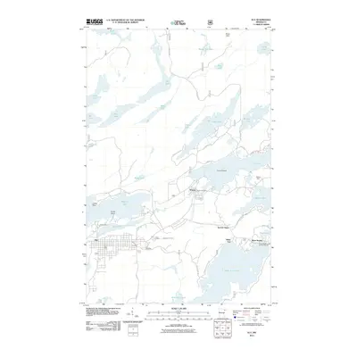
2011 Map of Ely
USGS Topo · Published 2011About this map
Pioneer Mine and its adjacent Miners Lake stand as central landmarks in this detailed study of the iron-rich landscape of the Boundary Waters periphery. The street grid of Ely provides the primary urban anchor, while the neighboring village of Winton sits at the head of the Shagawa River, housing the Winton Post Office and nearby Winton Dam. This area exhibits a dense concentration of interconnected waterways, where the flow of water dictates the historic industrial and recreational layout of the region.
Find a feature on this map
50 named features on this map. Tap any name to fly to it.
Don’t see what you’re looking for? This feature index may not catch every label — zoom into the map to look around manually.
Map Details
Editions of this 2011 Ely Map
This is the sole edition of this map. No revisions or reprints were ever made.
Other maps of this area

1933 · Ely
USGS Topo · 1:62,500

1939 · Ely
USGS Topo · 1:62,500

1954 · Two Harbors
USGS Topo · 1:250,000

1957 · Two Harbors
USGS Topo · 1:250,000

1957 · Gabbro Lake
USGS Topo · 1:62,500

1957 · Basswood Lake
USGS Topo · 1:62,500

1957 · Quetico
USGS Topo · 1:250,000

1958 · Two Harbors
USGS Topo · 1:250,000

1963 · Fourtown Lake
USGS Topo · 1:24,000
1963 · Angleworm Lake
USGS Topo · 1:24,000