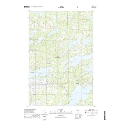
2019 Map of Ely
USGS Topo · Published 2019About this map
Ely serves as the primary hub in this portion of the Superior National Forest, where the transition from town to wilderness is marked by a complex network of waterways and trails. The map documents the relationship between the built environment of the city and the surrounding lake systems, including Shagawa Lake and the smaller Miners Lake. Higher education is represented by Vermilion Community College, while local history is anchored by Ely Cem and the nearby settlement of Winton at the edge of Fall Lake.
Find a feature on this map
70 named features on this map. Tap any name to fly to it.
Don’t see what you’re looking for? This feature index may not catch every label — zoom into the map to look around manually.
Map Details
Editions of this 2019 Ely Map
This is the sole edition of this map. No revisions or reprints were ever made.
Other maps of this area

1933 · Ely
USGS Topo · 1:62,500

1939 · Ely
USGS Topo · 1:62,500

1954 · Two Harbors
USGS Topo · 1:250,000

1957 · Two Harbors
USGS Topo · 1:250,000

1957 · Gabbro Lake
USGS Topo · 1:62,500

1957 · Basswood Lake
USGS Topo · 1:62,500

1957 · Quetico
USGS Topo · 1:250,000

1958 · Two Harbors
USGS Topo · 1:250,000

1963 · Fourtown Lake
USGS Topo · 1:24,000
1963 · Angleworm Lake
USGS Topo · 1:24,000