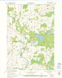
1969 Map of Embarrass
USGS Topo · Published 1991About this map
The Embarrass River meanders through the central lowlands of this 1969 survey, where the village of Embarrass serves as a local hub near the boundary of Shawano and Waupaca Counties. The landscape is a complex patchwork of wetlands and glacial lakes, including Pine Lake, Round Lake, and Grass Lake, which are bordered by extensive marshy tracts like the Navarino State Wildlife Area in the southeast.
Find a feature on this map
54 named features on this map. Tap any name to fly to it.
Don’t see what you’re looking for? This feature index may not catch every label — zoom into the map to look around manually.
Map Details
Editions of this 1969 Embarrass Map
2 editions found
Other maps of this area

1954 · Gresham
USGS Topo · 1:48,000

1954 · Shawano
USGS Topo · 1:48,000

1955 · Embarrass
USGS Topo · 1:48,000

1955 · Clintonville
USGS Topo · 1:48,000

1955 · Green Bay
USGS Topo · 1:250,000

1964 · Shawano
USGS Topo · 1:62,500

1964 · Gresham
USGS Topo · 1:62,500

1969 · Leeman
USGS Topo · 1:24,000

1969 · Embarrass
USGS Topo · 1:24,000

1969 · Lunds
USGS Topo · 1:24,000