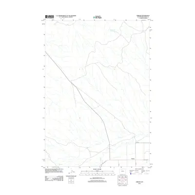
2012 Map of Emblem
USGS Topo · Published 2012About this map
Emblem serves as the primary focal point in this high-desert region of Big Horn County, Wyoming, situated at the junction of several rural routes including Co Rd 9 and Co Rd 10. The landscape is defined by the ephemeral drainage patterns of the Bighorn Basin, where seasonal waterways like Horse Cr and Dry Cr carve through the arid terrain. A significant man-made landmark in this sparsely populated area is the Sore Finger Reservoir, located in the northern portion of the quadrangle. The map captures a transition in land use, showing the grid of county roads such as Co Lane 33 that support local ranching and agricultural operations. This 2012 survey illustrates the modern infrastructure and water management systems necessary to sustain life in this corner of the state.
Find a feature on this map
7 named features on this map. Tap any name to fly to it.
Don’t see what you’re looking for? This feature index may not catch every label — zoom into the map to look around manually.
Map Details
Editions of this 2012 Emblem Map
This is the sole edition of this map. No revisions or reprints were ever made.
Other maps of this area

1951 · Burlington
USGS Topo · 1:24,000

1951 · Y U Bench NE
USGS Topo · 1:24,000

1951 · Otto
USGS Topo · 1:24,000

1955 · Cody
USGS Topo · 1:250,000

1958 · Cody
USGS Topo · 1:250,000

1962 · Cody
USGS Topo · 1:250,000

1966 · Gilmore Hill NE
USGS Topo · 1:24,000

1966 · North Emblem Reservoir
USGS Topo · 1:24,000

1966 · Gilmore Hill SE
USGS Topo · 1:24,000

1966 · Jack Horner Reservoir
USGS Topo · 1:24,000