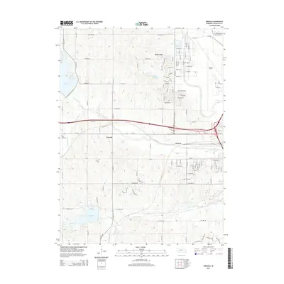
2014 Map of Emerald
USGS Topo · Published 2014About this map
Emerald and the neighboring community of Cushman anchor this landscape west of the Nebraska state capital, where the city's suburban edge meets a managed watershed. The Lincoln Airport dominates the northeast quadrant, while residential expansion is evident in the street grids of Huskerville. The terrain is defined by the tributaries of Middle Cr, which feed into major recreational and conservation water bodies including Pawnee Lake to the west and Conestoga Lake to the south.
Find a feature on this map
103 named features on this map. Tap any name to fly to it.
Don’t see what you’re looking for? This feature index may not catch every label — zoom into the map to look around manually.
Map Details
Editions of this 2014 Emerald Map
This is the sole edition of this map. No revisions or reprints were ever made.
Other maps of this area

1897 · Lincoln
USGS Topo · 1:125,000

1955 · Lincoln
USGS Topo · 1:250,000

1957 · Lincoln
USGS Topo · 1:250,000

1958 · Lincoln
USGS Topo · 1:250,000
1964 · Crete North
USGS Topo · 1:24,000
1964 · Garland
USGS Topo · 1:24,000

1964 · Denton
USGS Topo · 1:24,000

1964 · Roca
USGS Topo · 1:24,000
1964 · Pleasant Dale
USGS Topo · 1:24,000

1964 · Davey
USGS Topo · 1:24,000