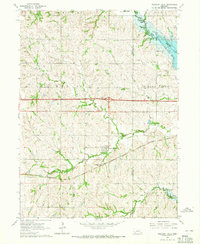
1964 Map of Pleasant Dale
USGS Topo · Published 1965About this map
The village of Pleasant Dale and its rural environs in eastern Nebraska are defined by the convergence of agricultural life and major water management projects in the mid-1960s. This survey highlights the newly established water bodies along the border of Seward and Lancaster counties, including Pawnee Lake State Recreation Area and Conestoga Lake State Recreation Area. These reservoirs, managed by the state, provide a distinct contrast to the traditional prairie drainage of Middle Creek and Culver Creek.
Find a feature on this map
25 named features on this map. Tap any name to fly to it.
Don’t see what you’re looking for? This feature index may not catch every label — zoom into the map to look around manually.
Map Details
Editions of this 1964 Pleasant Dale Map
2 editions found
Other maps of this area

1897 · Lincoln
USGS Topo · 1:125,000

1934 · Seward
USGS Topo · 1:48,000

1935 · Dorchester
USGS Topo · 1:48,000

1939 · Seward
USGS Topo · 1:62,500

1940 · Dorchester
USGS Topo · 1:62,500

1955 · Lincoln
USGS Topo · 1:250,000

1957 · Lincoln
USGS Topo · 1:250,000

1958 · Lincoln
USGS Topo · 1:250,000
1964 · Crete North
USGS Topo · 1:24,000
1964 · Dorchester
USGS Topo · 1:24,000