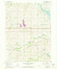
1964 Map of Pleasant Dale
USGS Topo · Published 1973About this map
Pleasant Dale serves as the focal point of this Seward County landscape, situated where the Burlington Northern railroad corridor meets the winding course of the Middle Creek. The village is a concentrated hub of rural life, supported by nearby institutions like the Pleasant Dale Cem and the Zion Ch. In the surrounding townships of I and P, the pattern of one-room schoolhouses like Maple Grove Sch and Burd Sch reflects a classic Midwestern educational network still visible in the early 1960s.
Find a feature on this map
27 named features on this map. Tap any name to fly to it.
Don’t see what you’re looking for? This feature index may not catch every label — zoom into the map to look around manually.
Map Details
Editions of this 1964 Pleasant Dale Map
2 editions found
Other maps of this area

1897 · Lincoln
USGS Topo · 1:125,000

1934 · Seward
USGS Topo · 1:48,000

1935 · Dorchester
USGS Topo · 1:48,000

1939 · Seward
USGS Topo · 1:62,500

1940 · Dorchester
USGS Topo · 1:62,500

1955 · Lincoln
USGS Topo · 1:250,000

1957 · Lincoln
USGS Topo · 1:250,000

1958 · Lincoln
USGS Topo · 1:250,000
1964 · Crete North
USGS Topo · 1:24,000
1964 · Dorchester
USGS Topo · 1:24,000