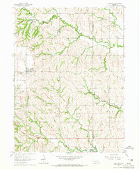
1964 Map of Garland
USGS Topo · Published 1965About this map
Garland serves as the primary hub in this mid-1960s survey of eastern Seward County, where the plains are defined by the convergence of Middle Oak Creek and West Oak Creek. The village's importance as a rail crossing is evident, with the Chicago and North Western and the Chicago Burlington and Quincy railroads intersecting near the center of town. This transportation network supported the surrounding agricultural township, indicated by the numerous country cemeteries and small rural institutions scattered throughout the sections.
Find a feature on this map
16 named features on this map. Tap any name to fly to it.
Don’t see what you’re looking for? This feature index may not catch every label — zoom into the map to look around manually.
Map Details
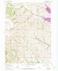
Editions of this 1964 Garland Map
2 editions found
Other maps of this area

1897 · Lincoln
USGS Topo · 1:125,000

1899 · Wahoo
USGS Topo · 1:125,000

1899 · David City
USGS Topo · 1:125,000

1934 · Seward
USGS Topo · 1:48,000

1939 · Seward
USGS Topo · 1:62,500

1955 · Fremont
USGS Topo · 1:250,000

1955 · Lincoln
USGS Topo · 1:250,000

1957 · Fremont
USGS Topo · 1:250,000

1957 · Lincoln
USGS Topo · 1:250,000

1958 · Fremont
USGS Topo · 1:250,000