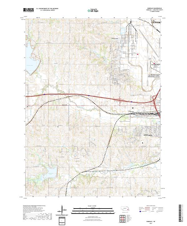
2021 Map of Emerald
USGS Topo · Published 2021About this map
Middle Creek and its many tributaries, including S Br Middle Cr and Haines Branch, carve a complex drainage pattern across this Lancaster County landscape. The western outskirts of Lincoln meet the rural community of Emerald, where local history is anchored by the Emerald Cem and Saint Johns Cem. This survey captures the critical transition from the urban grid of the state capital to the agricultural sections of the Plains, a change visible as the dense residential streets near Cushman give way to the open terrain surrounding Pheasant Ridge.
Find a feature on this map
55 named features on this map. Tap any name to fly to it.
Don’t see what you’re looking for? This feature index may not catch every label — zoom into the map to look around manually.
Map Details
Editions of this 2021 Emerald Map
This is the sole edition of this map. No revisions or reprints were ever made.
Other maps of this area

1897 · Lincoln
USGS Topo · 1:125,000

1955 · Lincoln
USGS Topo · 1:250,000

1957 · Lincoln
USGS Topo · 1:250,000

1958 · Lincoln
USGS Topo · 1:250,000
1964 · Crete North
USGS Topo · 1:24,000
1964 · Garland
USGS Topo · 1:24,000

1964 · Denton
USGS Topo · 1:24,000

1964 · Roca
USGS Topo · 1:24,000
1964 · Pleasant Dale
USGS Topo · 1:24,000

1964 · Davey
USGS Topo · 1:24,000