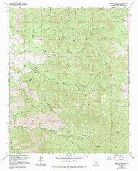
1972 Map of Emerald Mountain
USGS Topo · Published 1994About this map
The high ridges of the Piute Mountains dominate this 1970s landscape, an area defined by steep drainage systems and legacy mining operations. Gold and mineral exploration are evidenced by the Hard Luck Mine in the north and the Mammoth Eureka Mines near Barrel Spring in the south. The terrain is marked by numerous springs, such as Soda Springs and Mud Springs, which served as critical water sources for the scattered cattle operations indicated by several Corral markers throughout the canyons.
Find a feature on this map
47 named features on this map. Tap any name to fly to it.
Don’t see what you’re looking for? This feature index may not catch every label — zoom into the map to look around manually.
Map Details
Editions of this 1972 Emerald Mountain Map
2 editions found
Other maps of this area

1915 · Mojave
USGS Topo · 1:125,000

1943 · Tehachapi
USGS Topo · 1:62,500

1943 · Cross Mountain
USGS Topo · 1:62,500

1943 · Emerald Mtn
USGS Topo · 1:62,500

1943 · Mojave
USGS Topo · 1:62,500

1948 · Bakersfield
USGS Topo · 1:250,000

1955 · Bakersfield
USGS Topo · 1:250,000

1956 · Bakersfield
USGS Topo · 1:250,000
1956 · Mojave
USGS Topo · 1:62,500

1960 · Bakersfield
USGS Topo · 1:250,000