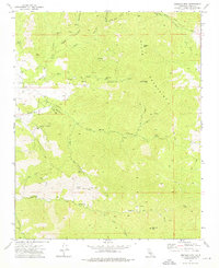
1972 Map of Emerald Mtn
USGS Topo · Published 1976About this map
The high elevations of the Piute Mountains dominate this 1972 survey, where the rugged topography is marked by a legacy of early California mining and remote ranching. Steep ridgelines like Antimony Ridge and peaks including Weldon Peak and Emerald Mtn define a landscape carved by numerous seasonal drainages, such as Jawbone Canyon and Caliente Canyon. For those tracing local history, the map preserves the location of the Wooden Shoe Annies Ranch (Ruins), a remnant of hardscrabble high-country life.
Find a feature on this map
43 named features on this map. Tap any name to fly to it.
Don’t see what you’re looking for? This feature index may not catch every label — zoom into the map to look around manually.
Map Details
Editions of this 1972 Emerald Mtn Map
2 editions found
Other maps of this area

1915 · Mojave
USGS Topo · 1:125,000

1943 · Tehachapi
USGS Topo · 1:62,500

1943 · Cross Mountain
USGS Topo · 1:62,500

1943 · Emerald Mtn
USGS Topo · 1:62,500

1943 · Mojave
USGS Topo · 1:62,500

1948 · Bakersfield
USGS Topo · 1:250,000

1955 · Bakersfield
USGS Topo · 1:250,000

1956 · Bakersfield
USGS Topo · 1:250,000
1956 · Mojave
USGS Topo · 1:62,500

1960 · Bakersfield
USGS Topo · 1:250,000