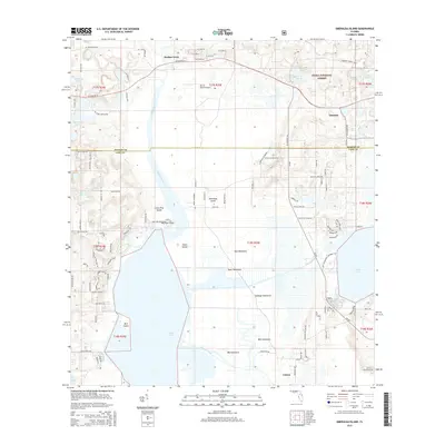
2015 Map of Emeralda Island
USGS Topo · Published 2015About this map
Starkes Ferry and the meandering Ocklawaha River anchor this landscape along the boundary of Marion and Lake counties. The map details a complex transition between the dry upland pine stands of the Ocala National Forest and the expansive wetlands of the Lake Griffin basin. Significant water features like Haynes Creek and Lake Yale dominate the southern half, punctuated by high-ground hammocks including Bull Hammock, Cabbage Hammock, and Big Hammock. This survey illustrates the intricate balance between conservation lands and local infrastructure, such as the Fly'n R Ranch Airport and the community of Linadale. Rural development is evidenced by a network of local roads such as Prairie Riding Loop and the Lake Yale Baptist Assembly Rd, which weave through the varied terrain of islands and ponds.
Find a feature on this map
60 named features on this map. Tap any name to fly to it.
Don’t see what you’re looking for? This feature index may not catch every label — zoom into the map to look around manually.
Map Details
Editions of this 2015 Emeralda Island Map
This is the sole edition of this map. No revisions or reprints were ever made.
Other maps of this area

1954 · Daytona Beach
USGS Topo · 1:250,000

1955 · Orlando
USGS Topo · 1:250,000

1957 · Orlando
USGS Topo · 1:250,000

1958 · Orlando
USGS Topo · 1:250,000

1958 · Daytona Beach
USGS Topo · 1:250,000

1962 · Orlando
USGS Topo · 1:250,000

1964 · Daytona Beach
USGS Topo · 1:250,000

1965 · Leesburg East
USGS Topo · 1:24,000

1965 · Umatilla
USGS Topo · 1:24,000

1966 · Leesburg West
USGS Topo · 1:24,000