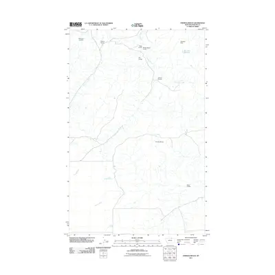
2011 Map of Emerick Bench
USGS Topo · Published 2011About this map
Emerick Bench and the high northern plains of Phillips County define this arid landscape, where water management is central to the local geography. The map illustrates a network of drainage features and catchments, most notably the Blue Stem Reservoir and various watercourses like Woody Island Creek and Cottonwood Creek. The terrain is characterized by numerous coulees—dry stream beds that flow only during heavy rains or snowmelt—including Coburg Coulee, Reservoir Coulee, and Alkali Coulee. These features represent the essential drainage system of the Missouri River watershed in northern Montana. Transportation in this part of the state remains sparse, anchored by routes like Black Coulee Rd, while landmarks such as Haystack Butte provide vertical orientation across the relatively flat benchlands. This 2011 survey serves as a modern record of the land use and natural hydrology in a rural agricultural region.
Find a feature on this map
13 named features on this map. Tap any name to fly to it.
Don’t see what you’re looking for? This feature index may not catch every label — zoom into the map to look around manually.
Map Details
Editions of this 2011 Emerick Bench Map
This is the sole edition of this map. No revisions or reprints were ever made.
Other maps of this area
1920 · Avery
USGS Topo · 1:125,000

1953 · Havre
USGS Topo · 1:250,000

1957 · Havre
USGS Topo · 1:250,000

1958 · Havre
USGS Topo · 1:250,000
1984 · Chapman
USGS Topo · 1:24,000
1984 · Emerick Bench
USGS Topo · 1:24,000
1984 · Hubert Hill SW
USGS Topo · 1:24,000
1984 · Down Reservoir NE
USGS Topo · 1:24,000
1984 · Hubert Hill SE
USGS Topo · 1:24,000
1984 · Down Reservoir
USGS Topo · 1:24,000