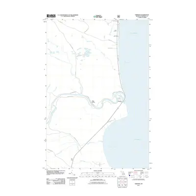
2011 Map of Emerson
USGS Topo · Published 2011About this map
Whitefish Bay and the shoreline of Lake Superior dominate this Upper Peninsula landscape, where the Tahquamenon River winds through low-lying coastal terrain before reaching its outlet. The settlement of Emerson sits near the river's mouth, a location historically tied to the timber and fishing industries of Chippewa County. Just north, the Paradise Post Office serves as a central landmark near local burial grounds including Baptist Cemetery and Our Lady of Victory Cemetery. Inland, the map reveals a network of small water bodies like Preacher Lake and Laurie Lakes, alongside roads with descriptive names such as Saw Dust Pile Rd and Target Range Rd. The presence of the Silver Creek Lodge further south along Hiawatha highway suggests the area's continued role as a gateway for outdoorsmen and travelers exploring the remote stretches of the Tahquamenon region.
Find a feature on this map
34 named features on this map. Tap any name to fly to it.
Don’t see what you’re looking for? This feature index may not catch every label — zoom into the map to look around manually.
Map Details
Editions of this 2011 Emerson Map
This is the sole edition of this map. No revisions or reprints were ever made.
Other maps of this area

1941 · Strongs
USGS Topo · 1:63,360

1951 · Shelldrake
USGS Topo · 1:24,000

1951 · McNearney Lake
USGS Topo · 1:24,000

1951 · Sheephead Lake
USGS Topo · 1:24,000

1951 · Emerson
USGS Topo · 1:24,000

1951 · Piatt Lake
USGS Topo · 1:24,000

1951 · Big Beaver Creek
USGS Topo · 1:24,000

1951 · Timberlost
USGS Topo · 1:24,000

1951 · Strongs
USGS Topo · 1:62,500

1951 · Eckerman
USGS Topo · 1:62,500