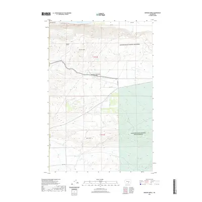
2020 Map of Emerson Nipple
USGS Topo · Published 2020About this map
Hanford Reach National Monument and the Saddle Mountain National Wildlife Refuge converge in this high-desert landscape defined by the prominent basalt rises of Umtanum Ridge and Yakima Ridge. The northern boundary is shaped by a wide bend of the Columbia River, where features like China Bar and McCoy Canyon mark the shoreline. Much of the central terrain is occupied by the Yakima Training Center, an expanse of arid ground dominated by the namesake peak of Emerson Nipple. Scattered water sources such as Juniper Springs, Wissel Spring, and Barrel Springs represent critical resources in this rain-shadow environment, while ephemeral drainage like Cold Cr and Dry Cr cross the sagebrush-covered flats.
Find a feature on this map
20 named features on this map. Tap any name to fly to it.
Don’t see what you’re looking for? This feature index may not catch every label — zoom into the map to look around manually.
Map Details
Editions of this 2020 Emerson Nipple Map
This is the sole edition of this map. No revisions or reprints were ever made.
Other maps of this area

1915 · Prosser
USGS Topo · 1:125,000

1916 · Coyote Rapids
USGS Topo · 1:62,500

1917 · Priest Rapids
USGS Topo · 1:62,500

1917 · Prosser
USGS Topo · 1:125,000

1948 · Cairn Hope Peak
USGS Topo · 1:24,000

1948 · Emerson Nipple
USGS Topo · 1:24,000

1948 · Priest Rapids
USGS Topo · 1:24,000

1950 · Grandview
USGS Topo · 1:62,500

1951 · Priest Rapids
USGS Topo · 1:62,500

1951 · Grandview
USGS Topo · 1:62,500