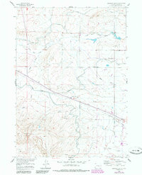
1960 Map of Emigrant Gap NE
USGS Topo · Published 1985About this map
Emigrant Gap Ridge dominates the southern landscape of this Natrona County survey, marking a significant topographical transition in the high plains. The intricate network of the Casper Canal, Bishop Lateral, and Johnson Lateral reveals the critical importance of water management in this arid ranching territory during the mid-twentieth century. These man-made watercourses cut across the natural drainage patterns of South Fork Casper Creek and several significant draws. Human activity is centered around the Thirtythree Mile Ranch, while the inclusion of Thirtythree Mile Road and Telephone Road alongside various pipelines illustrates the overlay of modern utility and transportation infrastructure onto traditional grazing lands. A solitary Radio Tower and a Gravel Pit further indicate the localized industrial and communication footprints within this expansive rangeland.
Find a feature on this map
15 named features on this map. Tap any name to fly to it.
Don’t see what you’re looking for? This feature index may not catch every label — zoom into the map to look around manually.
Map Details
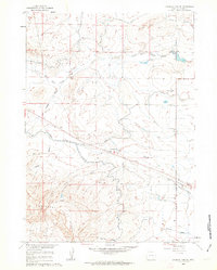
Editions of this 1960 Emigrant Gap NE Map
2 editions found
Other maps of this area

1950 · Emigrant Gap
USGS Topo · 1:24,000

1950 · Goose Egg
USGS Topo · 1:24,000

1950 · Emigrant Gap NE
USGS Topo · 1:24,000

1951 · Oil Mountain
USGS Topo · 1:24,000

1951 · Emigrant Gap NW
USGS Topo · 1:24,000

1952 · Bishop
USGS Topo · 1:24,000

1955 · Arminto
USGS Topo · 1:250,000

1955 · Casper
USGS Topo · 1:250,000

1958 · Casper
USGS Topo · 1:250,000

1958 · Arminto
USGS Topo · 1:250,000