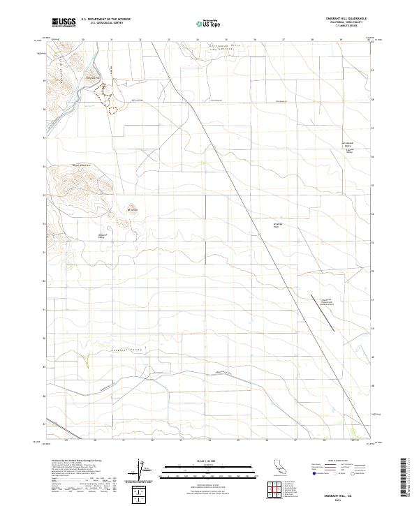
2021 Map of Emigrant Hill
USGS Topo · Published 2021About this map
The Pyramid Hills and Kettleman Hills define the western edge of the San Joaquin Valley on this 2021 landscape, where the transition from high desert peaks to the agricultural floor of the Antelope Plain is marked by intensive water management. The massive Governor Edmund G Brown Coastal Branch California Aqueduct snakes across the northern terrain near Emigrant Hill, while the Berrenda Mesa Canal cuts through the southern reaches of Antelope Valley. These engineering works support the industrial-scale farming operations that dominate the region, including the area surrounding the private Wonderful Pistachios & Almonds Airport. Named summits like Wagon Wheel Mtn and Mt Vernon provide a backdrop to a landscape that balances traditional livestock grazing terrain with the precision of modern California desert agriculture.
Find a feature on this map
22 named features on this map. Tap any name to fly to it.
Don’t see what you’re looking for? This feature index may not catch every label — zoom into the map to look around manually.
Map Details
Editions of this 2021 Emigrant Hill Map
This is the sole edition of this map. No revisions or reprints were ever made.
Other maps of this area

1914 · Lost Hills
USGS Topo · 1:125,000

1914 · Cholame
USGS Topo · 1:125,000

1915 · Cholame
USGS Topo · 1:125,000

1917 · Cholame
USGS Topo · 1:125,000

1930 · Avenal Gap
USGS Topo · 1:31,680

1932 · Antelope Plain
USGS Topo · 1:31,680

1932 · West Camp
USGS Topo · 1:31,680

1933 · Avenal Gap
USGS Topo · 1:31,680
1935 · West Camp
USGS Topo · 1:31,680
1936 · Antelope Plain
USGS Topo · 1:31,680